Who needs maps, now today’s navigation tool of choice is the satnav? Me, for one!
While a satnav is an easy and (usually) accurate way to get somewhere, following the satnav’s line doesn’t reveal the surprises, spectacles and curiosities of the land around you.
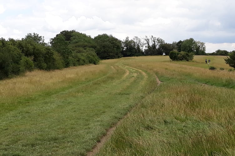
Thank goodness for Ordnance Survey (OS) maps, which played a big part in my wife and I’s leisure life! They reveal footpaths, tracks and roads, and their contour lines show hills, valleys and mountains.
Their symbols and letter codes indicate all manner of things from antiquities and landmarks to viewpoints and parking places.
.jpeg?width=209&height=140&crop=209:145,smart&quality=75)


OS maps have taken us to amazing places in our county and across the country. They’ve guided through gorgeous countryside along footpaths and country lanes, directed us to breath-taking views and led to us to discover features left by our ancestors hundreds and even thousands of years ago.
Most growing up today will never experience our anticipation and enjoyment in spreading out paper OS maps to plan walks, cycle rides and car drives!
OS maps covering Surrey were well-used friends as my wife and I explored the area on foot, cycle and in the car after we moved to Surrey, 44 years ago.
First there were the Landranger (1:50000 scale) maps in their pink covers. Before each UK holiday we bought or borrowed relevant maps from the 204 Landrangers covering the whole of Great Britain.
In the 1980s OS began to introduce its Outdoor Leisure (OL) maps covering National Parks and other areas of greatest interest to ramblers. At twice the scale (1:25000) these maps with yellow jackets provided much more information for leisure users.
Maps in the same scale and detail covering the rest of the country were added from the 1990s and known as the Explorer series with orange jackets, and the OL maps were added to their number: it totals 404 maps, covering the whole of the UK.
Nowadays as a wheelchair user it’s not possible for me to take wild country rambles along footpaths, tracks and trails marked on those trusty maps. But I still get pleasure from looking at OS maps: it reminds me of places I’ve been, prompts memories of sights I’ve seen, and even hints at what I might see in places I’ve not visited.
It reminds me of the satisfaction and excitement I felt when using an OS map to plan a day out.
Maps purchased nowadays come with a code enabling you to receive a free download of the map to your mobile phone.
For keen outdoor types, OS Maps Premium provides online access to all the maps they might need, all for either an annual subscription of £34.99 or a recurring monthly subscription of £6.99.
If you don’t want the hassle of planning your own walk there are lots of ideas online for great walks in Surrey. For general view, look at visitsurrey.com, surreyhills.org, walkingbritain.co.uk and surreycc.gov.uk/culture-and-leisure/countryside.
For details of individual walks try Alltrails (alltrails.com) which has a huge variety of routes uploaded by keen local walkers.
Take a look too at John Harris’s Walking in England (walkinginengland.co.uk) which links to dozens of walks of various lengths for Surrey alone – prepared by individuals and organisations – either as direct free downloads or as links to the walks on other websites.
If you’re fit and able, make an effort get out and explore our amazing countryside in 2026.
Happy New Year!
Comments
This article has no comments yet. Be the first to leave a comment.